
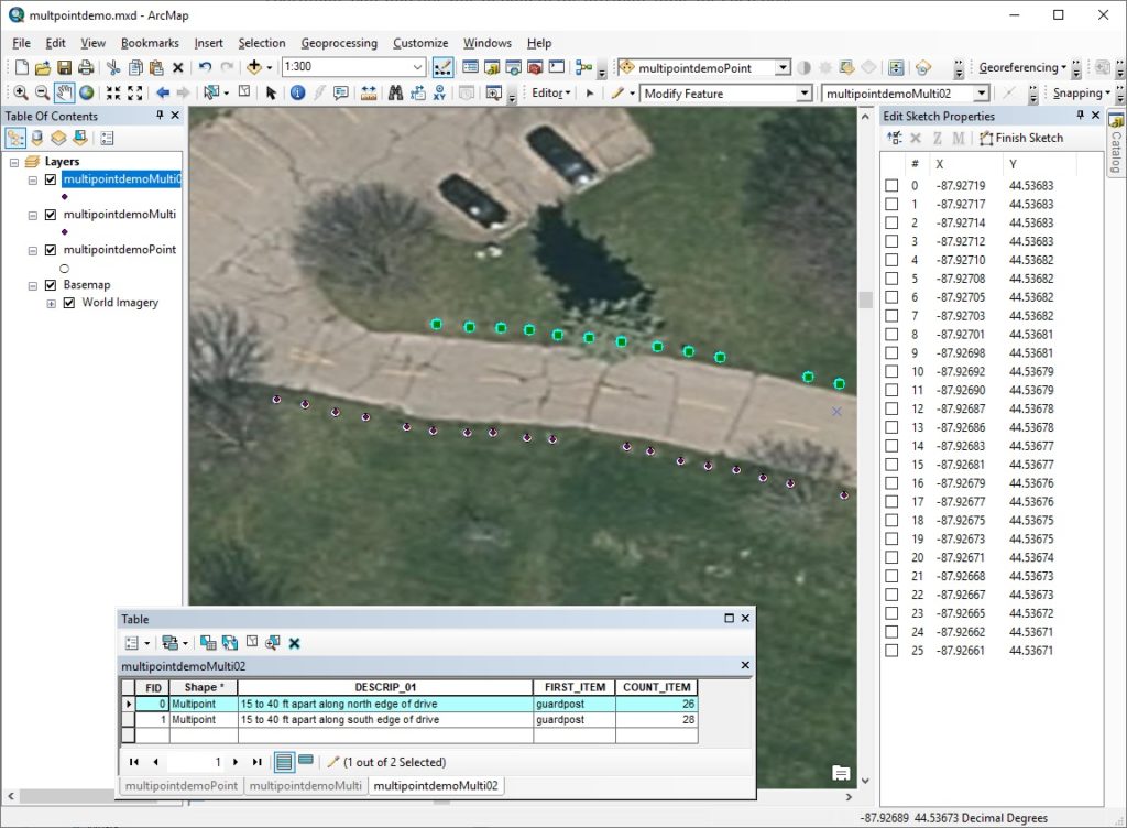
Let’s say that we’re building a geographic information system for UWGB’s Green Bay campus. One of our data development tasks is to map the guardposts at UW-Green Bay’s Communiversity Park to a shapefile feature class. Because we care about the locations of all the posts, but we don’t need to record separate descriptive information for each one, we decide to divide the posts into several subsets and represent each subset with a group of dimensionless points (the multipoint geometry approach). The result is illustrated below. Note that there is one multipoint feature for the 26 posts along the north edge of the driveway and one for the 28 posts along the south edge. The dataset’s attribute table has one set of values (called a record or data line) for each of the two multipoint features.
Comments are closed.