
The great majority of the feature data that we encounter or create in our work is stored in a data structure called a feature class. A feature class is a set of computer files containing location and tabular information for a bunch of like events, objects or conditions, all of which are mapped using the same class of geometric shapes. Examples include:
- Toxic spill release locations mapped as points
- Toxic spill impact zones mapped as polygons
- Road routes mapped as lines
- Road pavement mapped as polygons
The data structures we encounter in our work are described below:
Point Feature Class
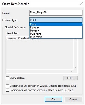
The great majority of our work involves events, objects or conditions that are represented by single, discrete points. When creating the files to store this kind of data, the author configures the fileset as a point feature class as shown above. Properties include:
- The fileset employs one of the recognized file structures for storing feature data; shapefile, file geodatabase, ArcInfo coverage, etc
- Each feature consists of one and only one point
- Each feature has one and only one data row in the attribute table
Multipoint Feature Class
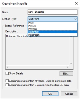
Occasionally our work involves events, objects or conditions that are represented by groups of points. When creating the files to store this kind of data, the author configures the fileset as a multipoint feature class as shown above. Properties include:
- The fileset employs one of the recognized file structures for storing feature data; shapefile, file geodatabase, ArcInfo coverage, etc
- Each feature consists of a group of points. The number of points in the group can be anywhere from 1 to a whole bunch.
- Each feature has one and only one data row in the attribute table
XY Data Table
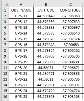
We don’t need formal GIS data structures (shapefile and/or geodatabase feature classes) to view discrete points in GIS software. Simple tables, referred to as “XY data” can be used as well.
- The table employs one of several file formats available for storing information in rows and columns; Excel spreadsheet, delimited text (.txt or .csv), dBase table (.dbf), etc
- The table includes a header line plus one data line for each point defined in the table.
- The table can have as many columns as needed to store the attribute values for each point, but must include columns for the point’s name, its north-south coordinate value and its east-west coordinate value.
Line Feature Class
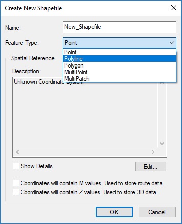
Some our work involves events, objects or conditions that are represented by lines. Think watercourses, street centerlines, tornado tracks, etc. When creating the files to store this kind of data, the author configures the fileset as a line feature class as shown above. Properties include:
- The fileset employs one of the recognized file structures for storing feature data; shapefile, file geodatabase, ArcInfo coverage, etc
- Each feature consists of one continuous (single-part) line or one discontinuous (multipart) line.
- Each feature has one and only one data row in the attribute table
Polygon Feature Class
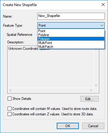
Some of our work involves events, objects or conditions that are represented by polygons. Think water bodies, building footprints, land ownership, etc. When creating the files to store this kind of data, the author configures the fileset as a polygon feature class as shown above. Properties include:
- The fileset employs one of the recognized file structures for storing feature data; shapefile, file geodatabase, ArcInfo coverage, etc
- Each feature consists of one continuous (single-part) polygon or one discontinuous (multipart) polygon.
- Each feature has one and only one data row in the attribute table
Comments are closed.